Science & SkepticismSatellite Sessions: Surfers and Scientists on a Quest for Healthier Coastlines

A love for the sea begins with an inherent admiration for the coastal environment. Barren cliff edges, lush green hills, bouldered bays, white-sand beaches, reef-clad lagoons, clay-colored river mouths; an eclectic array of sea-land interactions to satisfy all palates. But rather than setting boundaries, coastlines work as a transition zone between elements; providing a passage from our terrestrial reality into the enigmas of the underwater world. These are precious habitats, rich in marine biodiversity, both non-renewable and renewable energy, and endless means of recreation. Our species acknowledges such value and tends to congregate along the coast, invariably increasing the demand for a “piece of land by the sea”, and consequently affecting the very milieu many of us hold dear. Things like variations in sea-surface temperatures (often correlated with coral bleaching), overfishing, habitat degradation, marine species loss, pollution by chemicals, climate change, and hypoxia are some of the ways in which nearshore areas have been disrupted. So, in order to preserve harmony within the seashore environment, mankind has developed the concept of coastal management: a way to minimize negative impacts without affecting – and in fact, sometimes optimizing – the socio-economic opportunities that exist where the land and sea meet.
Coastal management is achieved through monitoring important environmental variables like the sea surface temperature (SST) – a variable used to understand the biological, physical, and chemical changes that coastal waters and its inhabitants undergo –, which in turn provide the necessary information to address short and long-term fluctuations in the behavior of ecosystems. SST influences the distribution of marine animals and how they feed, as well as how the sea-atmosphere gas exchange occurs, impacting not only regional but global climates. Nowadays, such monitoring is either done in situ – using research vessels and buoys – or remotely – via satellites, aircrafts, and fixed video cameras. The first method is expensive and often challenged by the effects of tides, complex bathymetry, wave shoaling, and coastal currents, whilst the latter not only shares the first’s high cost characteristic but also faces difficulties due to things like optical complexity of waters, atmospheric correction, and limited range, which ultimately demands calibration and validation of data by comparison with that from in situ platforms. A matter-of-fact approach for improving the sampling coverage in coastal zones has been to consider alternatives such as ‘citizen science’, where a network of volunteers is utilised to assist professionals (or in this case, operating systems) in their “quest for improved sampling coverage”. Interestingly, in the past few years scientists have almost intuitively merged a series of recreational activities with the power of data processing to establish a mutually beneficial network to optimize our understanding of the coastal environment.

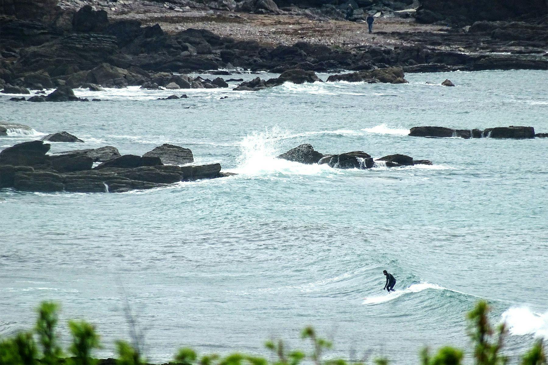
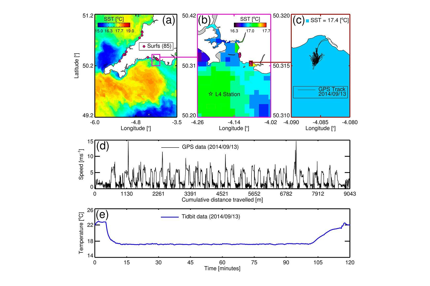
In 2015, a study conducted by Dr. Robert Brewin of Plymouth Marine Laboratory explored the idea of using surfers to enhance the gathering of SST data in nearshore regions. Their choice of experimenting with surfing was justified by the fact that it is one of the most practiced activities out of all water-related sports undertaken at the coastline; as well as the fact that surfers are intrinsically concerned about the welfare of the marine environment. So between the 5th of January 2014 and the 4th of January 2015th a surfer subject was observed in 85 surf sessions (~ 2012 waves caught; 90.6 hours surfed; 375.8 km covered; 110.8 km ridden) around the South West of the UK. He was equipped with a Tidbit V2 temperature logger – which was attached to the leash – and a Garmin Etrex 10, stored in a water-resistant waist-bag, to obtain GPS information. The SST data gathered by the surfer was then compared with that collected by the local L4 oceanographic station – as well as with satellite data – to determine whether the information was reliable. The experiment showed a close match between the data collected by the surfer and in situ information at station L4, illustrating the potential of using surfers to assist in the monitoring of SST in coastal zones.

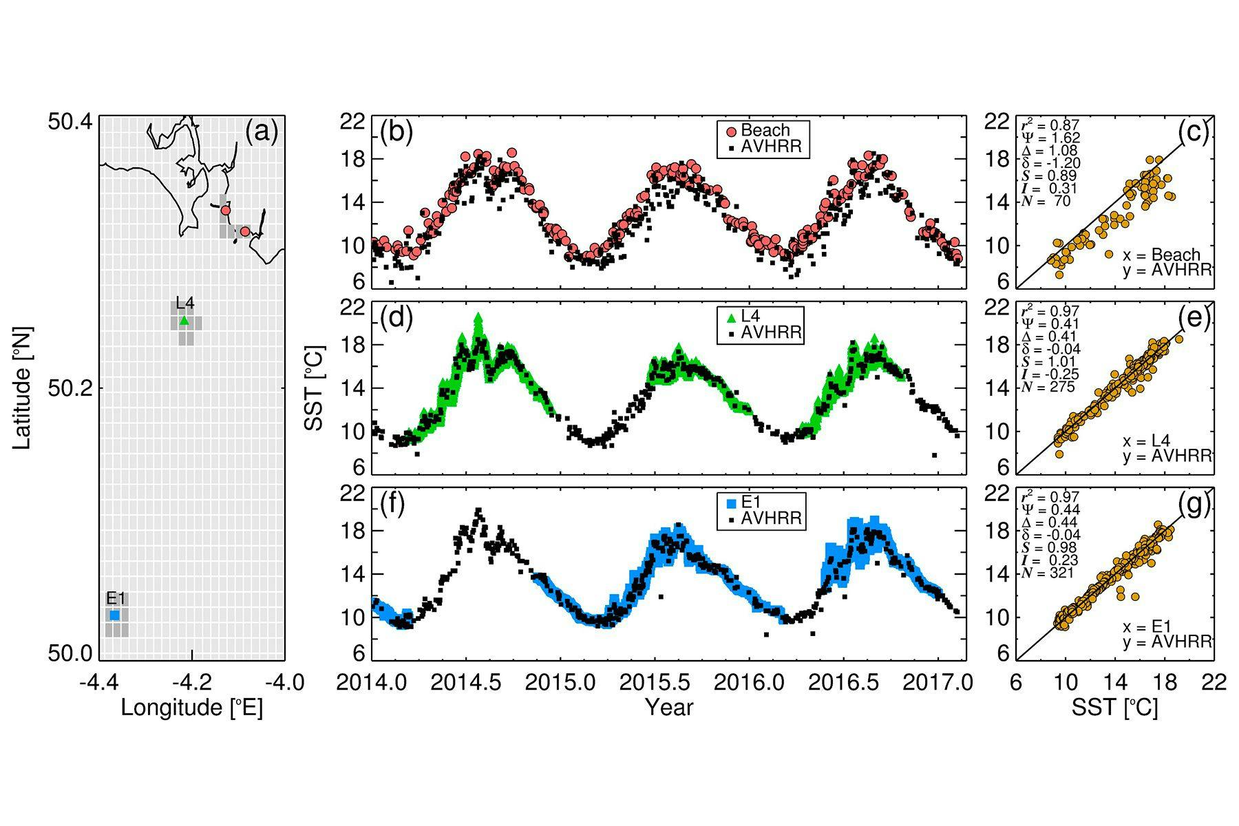
Aware of the issues surrounding the reliability of data collected in surf sessions, members of the Plymouth Marine Laboratory conducted another experiment in 2017 to check the accuracy and precision of coastal SST data complied by AVHRR (Advanced Very High Resolution Radiometer) scanning sensors mounted on satellite platforms. The AVHRR device measures thermal radiation emitted from the ocean and sends the data to be processed by NEODAAS (NERC Earth Observation Data Acquisition and Analysis Service), a service used in the UK and Europe to support various international research projects. In the open ocean, the understanding of satellite measurements is fair, since there is an array of in-situ stations to compare results with. Conversely the accuracy of these measurements in coastal zones is rather poor due to the lack of in situ information. So in order to address such uncertainty – and thus improve the understanding of the performance of AVHRR SST data – Dr. Brewin and his team equipped another group of surfers with the same recording devices as used in the previous experiment, this time observing them for a period of three years along the coast of the UK and Ireland. The data collected by the surfers was compared with two autonomous buoys, L4 and E1 (at 7 km and 33 km from the coastline of Plymouth respectively), as well as with satellite information provided by NEODASS. The AVHRR data showed a performance error higher than that acceptable in cases that require accurate and detailed measurements, whilst readings from surf sessions once again equated with that of the in situ platforms and, as stated on the published paper, indicate that “one can be confident using the surfer SST data for coastal applications”.

Such results – together with recent technological developments in the miniaturization of sensors, cloud data storage, and wireless communication that are being pursued within the Smartfin project – show that this ‘surf-research setup’ now only requires active participants if it is to expand the frontiers of citizen science. If all UK surfers were equipped to measure environmental indicators then it is estimated that there would be around 40 million independent measurements per year. Alternatively, if one in a hundred surfers partook in data collection there could be over 400,000 measurements collected each year in the UK. Not only is surfing a world-wide activity, but surfers tend to explore remote and uninhabited regions – as well as countries with a lack of coastal management and that sometimes feature vulnerable reef environments – which could benefit from a better understanding of the behavior of its coastal waters. Moreover, there is a positive for those surfers with electronic gadgets on or dangling behind their boards, as the information gathered by the GPS could be used to improve performance and store data about surf sessions and spots. The use of aquatic recreational activities such as surfing, diving, kayaking, fishing, stand-up paddleboarding, and sailing offer a cost effective method of monitoring coastal waters and thus improving our understanding of how the planet is responding to human activity. Yet there seems to be an underlying feature to these discussions that goes beyond the collection of scientific data, and that is to re-establish an intrinsic human-nature interaction, which for surfers means getting back to the essence of connecting with the ocean.
Surf Simply would like to thank Dr. Robert Brewing, the Plymouth Marine Laboratory, and the NCEO for their assistance producing this article.